Accessibility Dimension
 Accessibility
Learning objective
By the end of this page you'll be able to configure all five Accessibility factors with point data for the facilities they measure, choose an appropriate travel mode and distance thresholds, and understand how service-area buffers turn proximity into a 0–5 score.
The Accessibility Dimension evaluates people's daily mobility by examining their access to essential services. Levels of enablement for work access in this dimension are determined by service areas, which represent the geographic zones that facilities like childcare, supermarkets, universities, banks, and clinics can serve based on proximity. The nearer these facilities are to where people live, the more supportive and enabling the environment becomes for their participation in the workforce. For more information on data input used from open sources, see Getting Data.
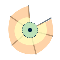
Every Accessibility factor uses the Distance by Road technique (see Processor Types). Configure each one using the generic pattern: double-click, point it at the relevant point data, and right-click → Run Item Workflow once you're done.
General Overview
This tool evaluates how easily people can access essential services and amenities, considering their potential caregiving roles and daily travel needs. It uses geospatial area analysis with OpenStreetMap (OSM) data to measure accessibility for several factors, including:
 Women’s Travel Patterns: Access to everyday services like pharmacies, markets, supermarkets, childcare centers, schools and parks.
 Access to Public Transport: Proximity to bus stops, train stations and other transport facilities.
 Health Facilities: Availability of clinics, hospitals and other healthcare services.
 Education and Training Facilities: Distance to colleges, universities and other training centers.
 Financial Facilities: Access to banks and financial support institutions.
Travel mode: The user can select walking or driving as a travel mode, and it is recommended that the same travel mode should be selected for all accessibility factors. The default travel mode is walking due to its inclusive nature.
Measurement: The default measurement for travel is distance in meters, which is most appropriate for walking. These thresholds are based on evidence from the literature at the factor level and are designed to provide consistency across analyses. If driving is selected as a travel mode, time in minutes is a more appropriate measurement.
Thresholds: They can be adjusted depending on the scope of the analysis. This might be a broader scale, such as the national level, or a more localized context, such as urban or regional areas.
💡 Tip: If evidence from the local context suggests alternative thresholds and increments are more appropriate, the user can alter these increments. If the selected travel mode is driving, the equivalent measurement increments should be in minutes and informed by the local context (for example, if evidence suggests the maximum time that women spend driving is 30 minutes, the increments could be 6, 12, 18, 24, 30).
Output: The process generates zones around these amenities, showing how far people can travel on foot or by car within increasing distances or times. Each zone is assigned a score from 5 (high accessibility) to 0 (no accessibility), reflecting decreasing accessibility as distance or travel time increases.
Input Accessibility factors
Women’s Travel Patterns (WTP)
Women's Travel Patterns (WTP) refer to the unique travel behaviors of women, often involving multiple stops for household or caregiving tasks, making proximity to essential services like markets, supermarkets, childcare centers, primary schools, pharmacies and green spaces crucial. This factor is composed of 5 subfactors which provide additional granularity: kindergartens/childcare, primary schools, groceries, pharmacies and green spaces.
Configure it using the generic pattern: double-click, point each subfactor at its point data (or Download from OSM), adjust the travel mode and thresholds if needed, then run it.
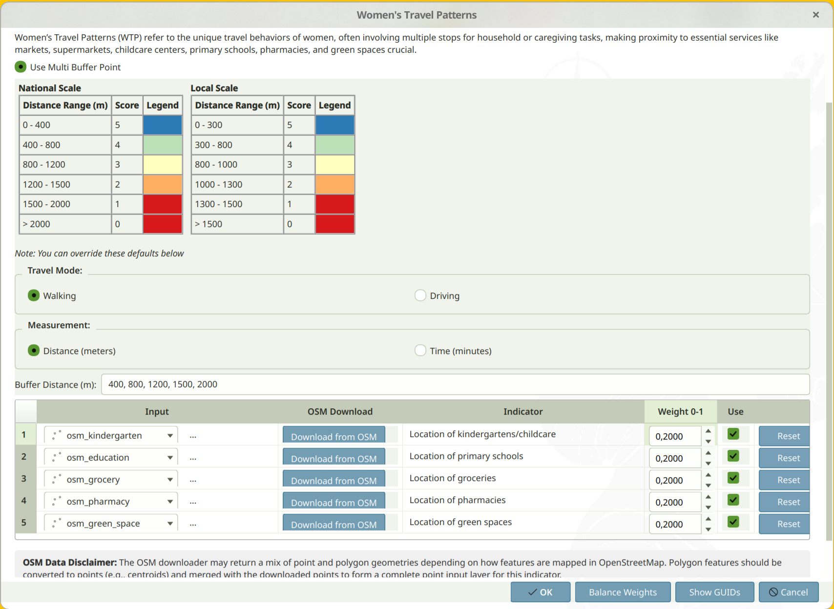
Default Women's Travel Patterns thresholds:
| Distance to Facilities (meters) (National Level Analysis) |
Score | Distance to Facilities (meters) (Local Level Analysis) |
Score |
|---|---|---|---|
| 0 - 400 | 5 | 0 - 300 | 5 |
| 401 - 800 | 4 | 301 - 800 | 4 |
| 801 - 1,200 | 3 | 801 - 1,000 | 3 |
| 1,201 - 1,500 | 2 | 1,001 - 1,300 | 2 |
| 1,501 - 2,000 | 1 | 1,301 - 1,500 | 1 |
| Over 2,000 | 0 | Over 1,500 | 0 |
Access to Public Transport
Access to Public Transport focuses on the availability and proximity of public transportation stops, which is crucial for people that rely on buses, trains, or trams to access jobs, education, and essential services.
Configure it using the generic pattern: double-click, point it at your public transportation stops layer (including maritime stops), adjust the travel mode and thresholds if needed, then run it.
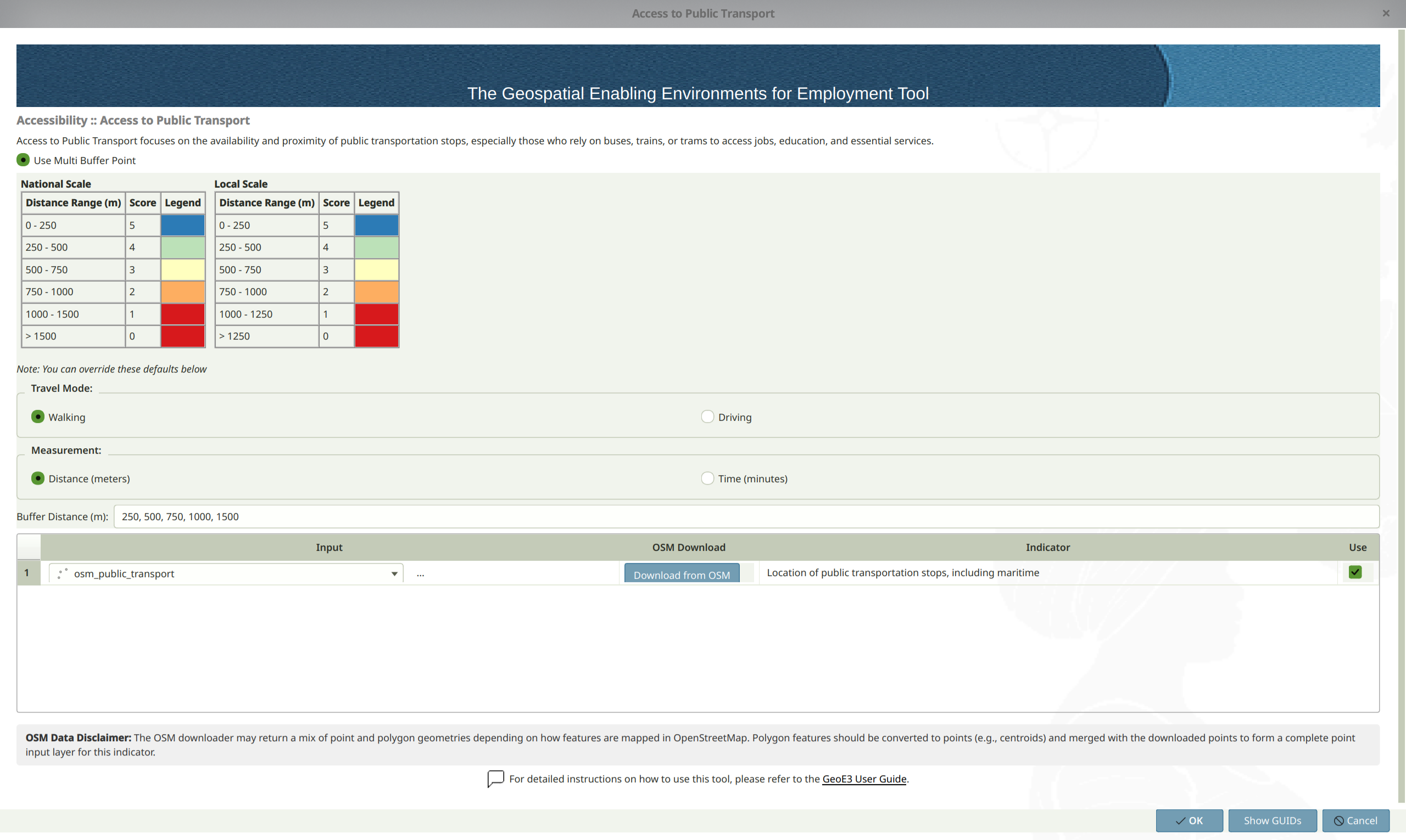
Default Access to Public Transport thresholds:
| Distance to Public Transport Stops (meters) (National Level Analysis) |
Score | Distance to Public Transport Stops (meters) (Local Level Analysis) |
Score |
|---|---|---|---|
| 0 - 250 | 5 | 0 - 250 | 5 |
| 251 - 500 | 4 | 251 - 500 | 4 |
| 501 - 750 | 3 | 501 - 750 | 3 |
| 751 - 1,000 | 2 | 751 - 1,000 | 2 |
| 1,001 - 1,500 | 1 | 1,001 - 1,250 | 1 |
| Over 1,500 | 0 | Over 1,250 | 0 |
Access to Health Facilities
Access to Health Facilities evaluates how easily people can reach healthcare services in terms of distance, impacting their well-being and ability to participate in the workforce.
Configure it using the generic pattern: double-click, point it at your hospitals and clinics layer, adjust the travel mode and thresholds if needed, then run it.
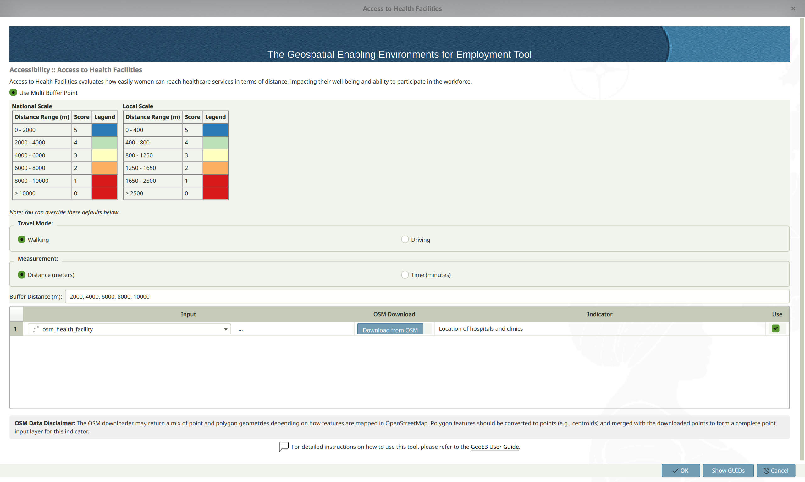
Default Access to Health Facilities thresholds:
| Distance to Health Facilities (meters) (National Level Analysis) |
Score | Distance to Health Facilities (meters) (Local Level Analysis) |
Score |
|---|---|---|---|
| 0 - 2,000 | 5 | 0 - 400 | 5 |
| 2,001 - 4,000 | 4 | 401 - 800 | 4 |
| 4,001 - 6,000 | 3 | 801 - 1,250 | 3 |
| 6,001 - 8,000 | 2 | 1,251 - 1,650 | 2 |
| 8,001 - 10,000 | 1 | 1,651 - 2,500 | 1 |
| Over 10,000 | 0 | Over 2,500 | 0 |
Access to Education and Training Facilities
Access to Education and Training Facilities assesses the proximity to higher education institutions and training centers, influencing people's ability to gain necessary qualifications.
Configure it using the generic pattern: double-click, point it at your universities and technical schools layer, adjust the travel mode and thresholds if needed, then run it.
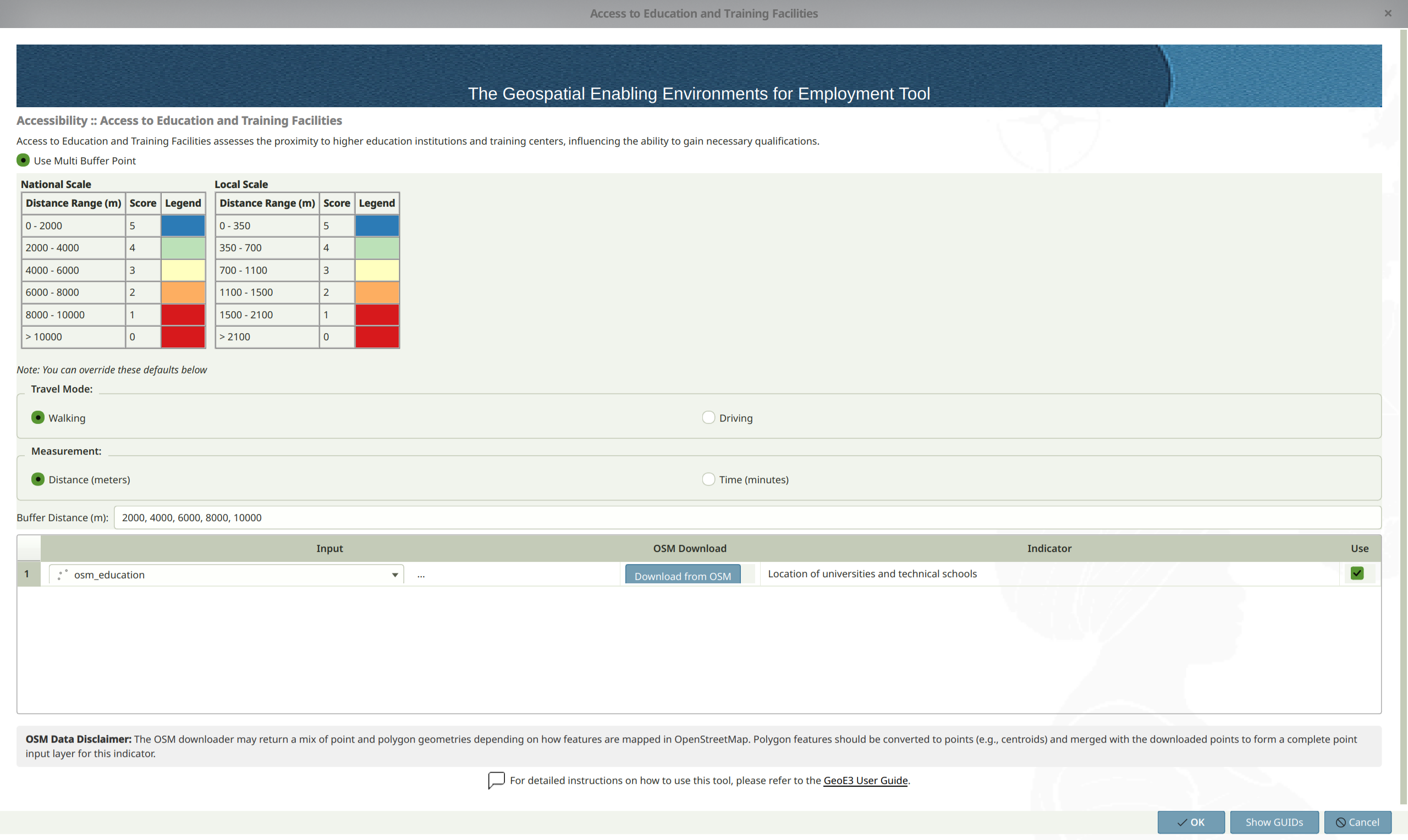
Default Access to Education and Training Facilities thresholds:
| Distance to Facilities (meters) (National Level Analysis) |
Score | Distance to Facilities (meters) (Local Level Analysis) |
Score |
|---|---|---|---|
| 0 - 2,000 | 5 | 0 - 350 | 5 |
| 2,001 - 4,000 | 4 | 351 - 700 | 4 |
| 4,001 - 6,000 | 3 | 701 - 1,100 | 3 |
| 6,001 - 8,000 | 2 | 1,101 - 1,500 | 2 |
| 8,001 - 10,000 | 1 | 1,501 - 2,100 | 1 |
| Over 10,000 | 0 | Over 2,100 | 0 |
Access to Financial Facilities
Access to Financial Facilities focuses on the proximity of banks and financial institutions, which is essential for people's economic empowerment and ability to access credit.
Configure it using the generic pattern: double-click, point it at your banks and financial facilities layer, adjust the travel mode and thresholds if needed, then run it.
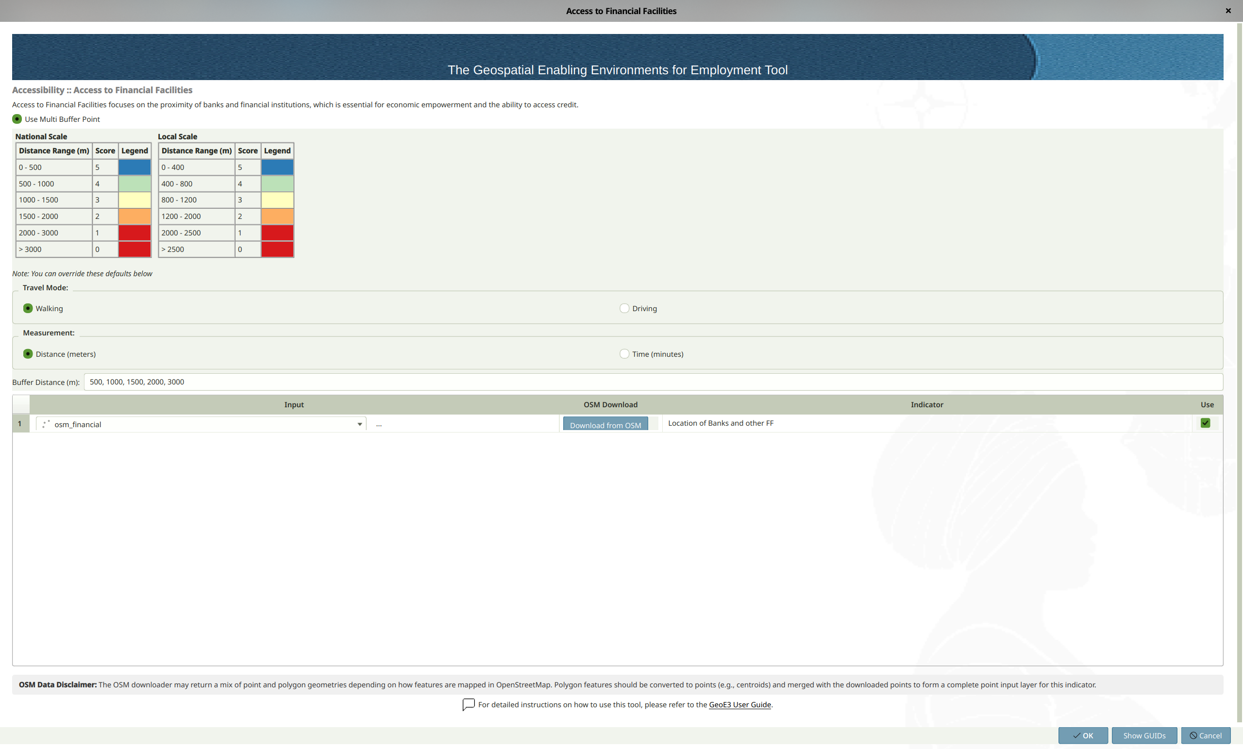
Default Access to Financial Facilities thresholds:
| Distance to Financial Facilities (meters) (National Level Analysis) |
Score | Distance to Financial Facilities (meters) (Local Level Analysis) |
Score |
|---|---|---|---|
| 0 - 400 | 5 | 0 - 500 | 5 |
| 401 - 800 | 4 | 501 - 1,000 | 4 |
| 801 - 1,200 | 3 | 1,001 - 1,500 | 3 |
| 1,201 - 2,000 | 2 | 1,501 - 2,000 | 2 |
| 2,001 - 3,000 | 1 | 2,001 - 2,500 | 1 |
| Over 3,000 | 0 | Over 2,500 | 0 |
Once every factor has its data, double-click the Accessibility dimension and follow the same generic pattern as every other item in the tree: assign weights, balance them, and run it.
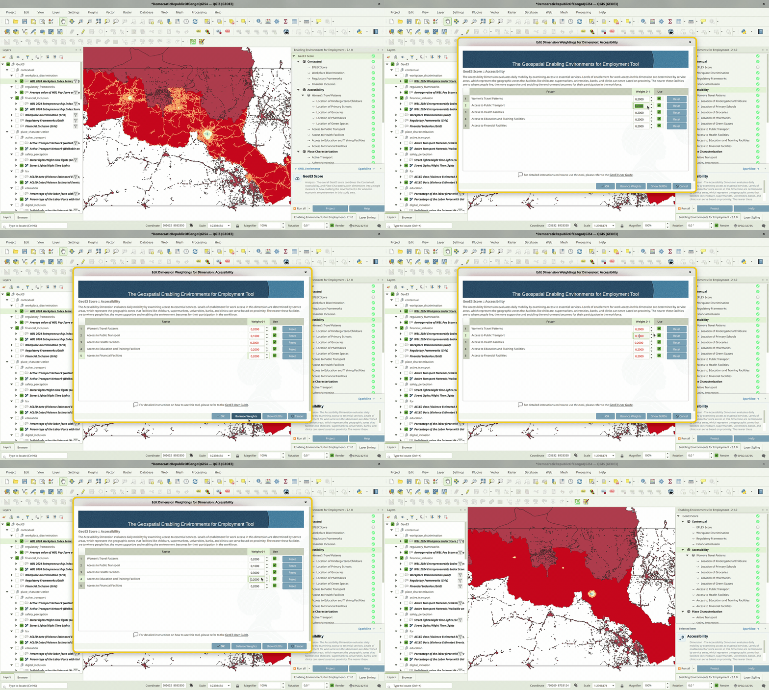
The outputs (all five factors and their subfactors, plus their aggregation into the final Accessibility score) land in the Accessibility folder within your project folder, on the usual 0–5 enablement scale.
Recap
- All five Accessibility factors need point data for the facility they measure. Grab it with the in-app Download from OSM button, or see Getting Data for alternatives.
- Pick one travel mode (walking or driving) and stick with it across every factor for consistent, comparable results.
- Distance thresholds differ by factor and by national vs. local scale. The defaults are evidence-based, but override them if your local context calls for it.
- Results combine into a single Accessibility output on the usual 0–5 enablement scale.