Post-update OSM data report#
This project focused on mapping and improving buildings and roads in 22 refugee camps in Chad. Additionally, water bodies like rivers and streams were included where they occured; but in less quantity since these features were not found in all the camps.
The mapping was done following good practices of OSM mapping, mainly during the validation and improvement of the existing data on the map added by other mappers from the OSM community.
Mapping Tools:#
OpenStreetMap: A collaborative project to create free and editable maps. All the data were updated directly here.
JOSM: The OpenStreetMap editor used by the data team to do edits easier and faster.
Tasking Manager: OSM management tool to avoid conflicts during the mapping process.
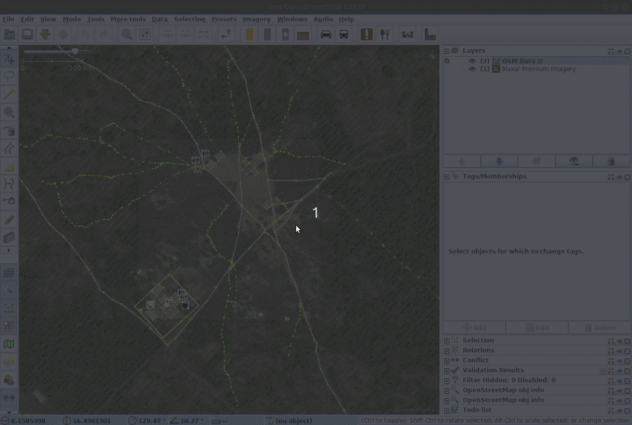
Fig. 42 Mapping workflow with JOSM editor and a Tasking Manager#
Validating existing OSM data#
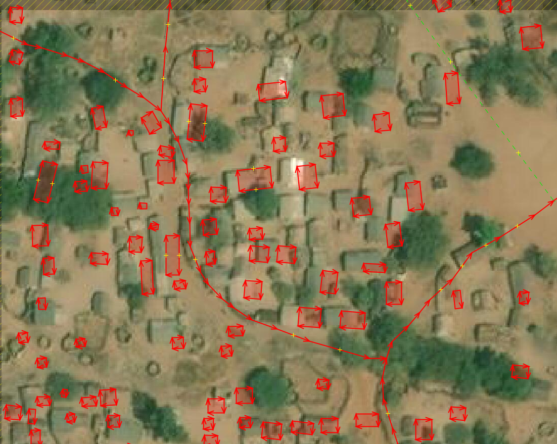
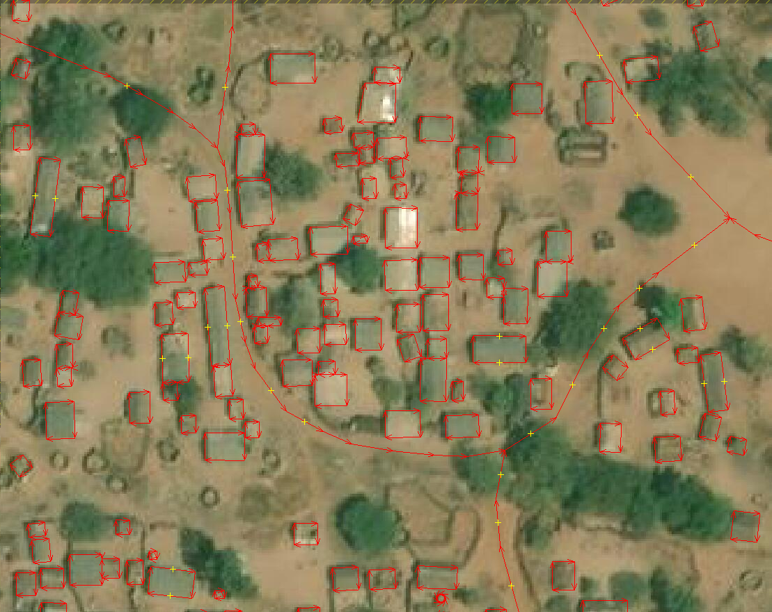
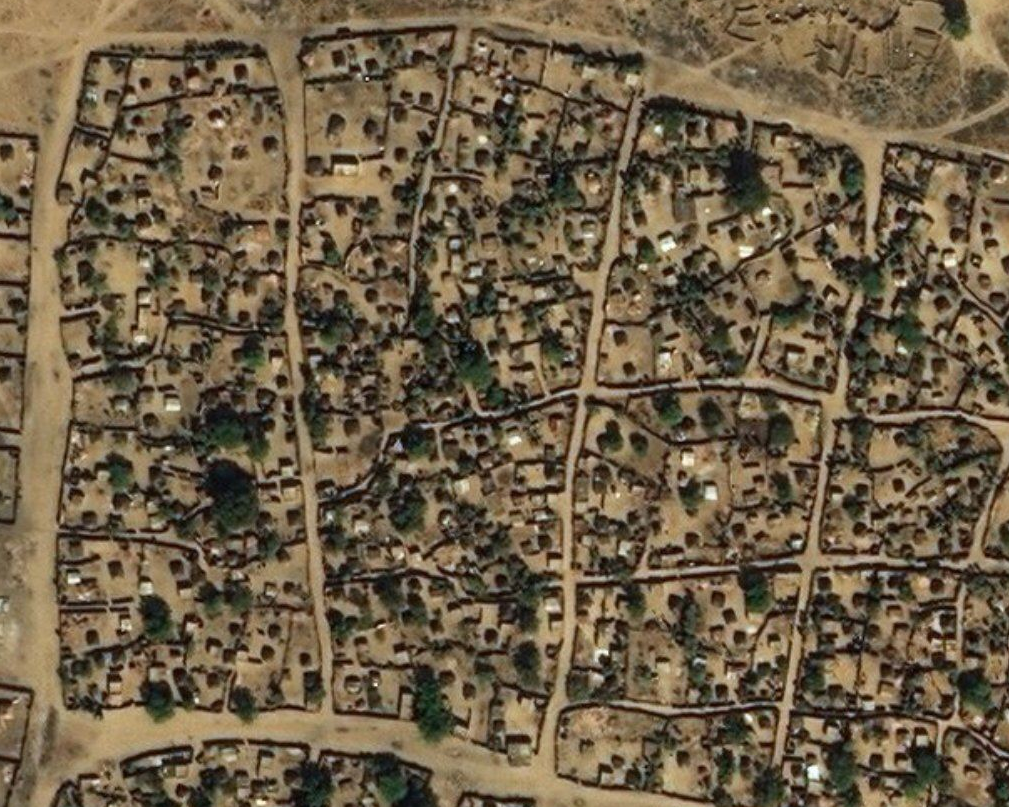
Previous to the mapping process we found data added by other mappers from the OSM community and most of this data was added trough projects from Humanitarian OpenStreetMap Team.
Some of these data had good quality but in most of the camps data had to be improved to align to the most current imagery and improve the building and road shapes.
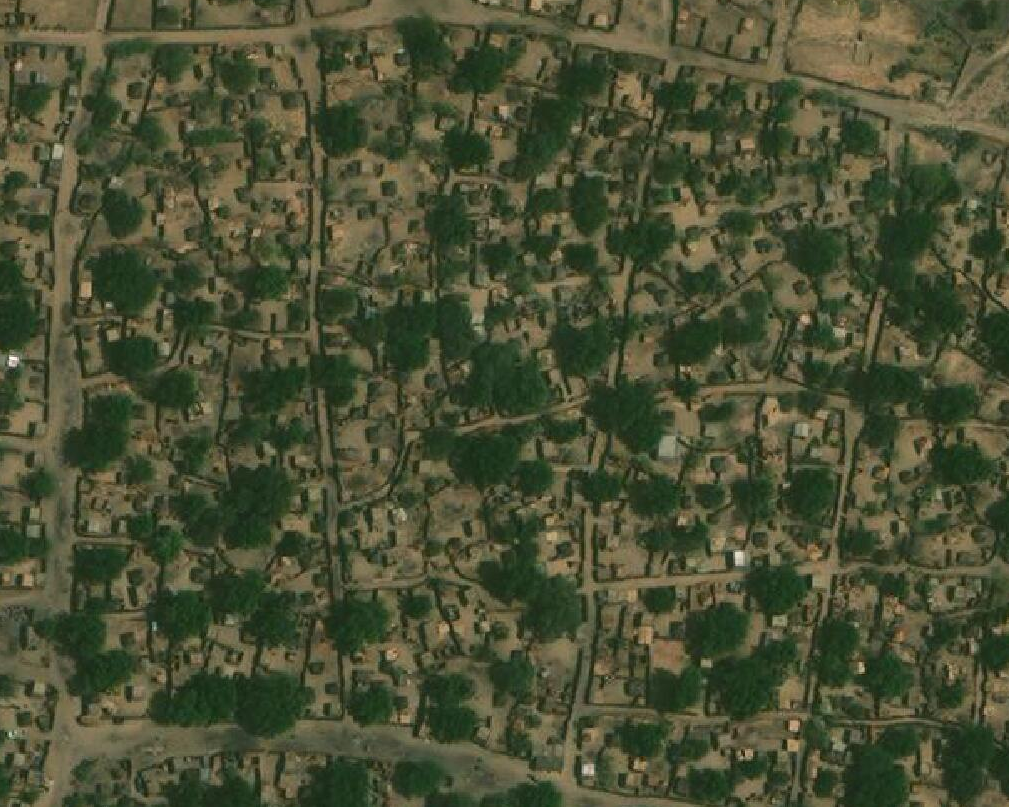
Although the team relied on the most current imagery basemap (Maxar premium), data were found that did not match with any satellite imagery and according to the source attributes, they were added by local knowledge. These data were not changed and were left as they were found.
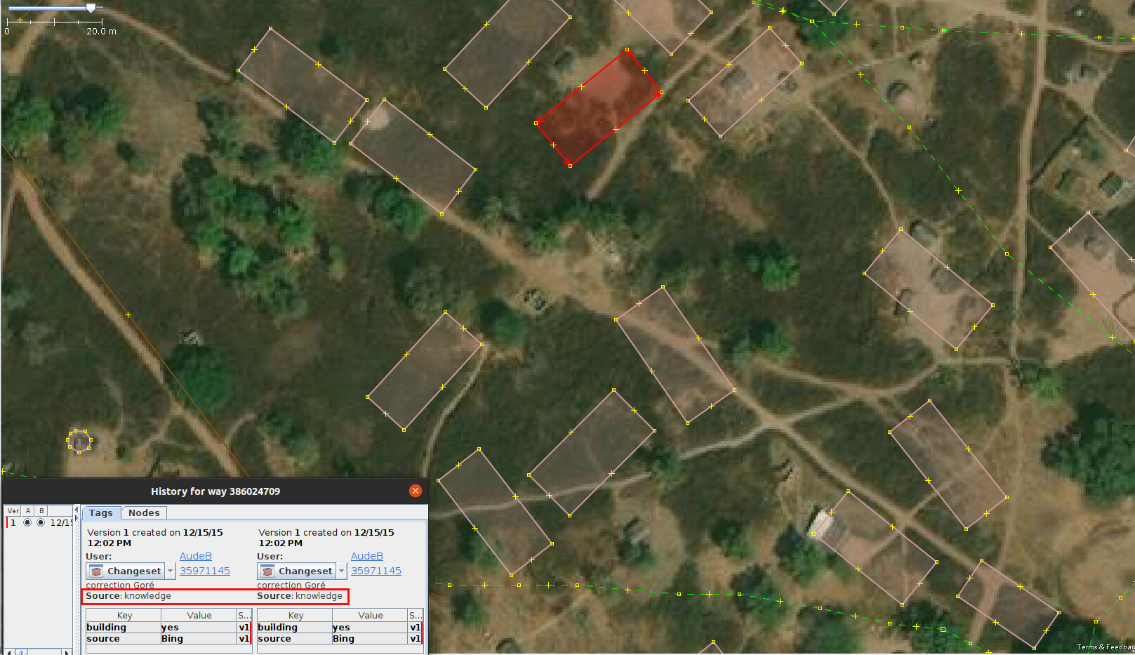
Fig. 45 Buildings and highways added by local knowledge#
Mapping of camps without data#
There were camps that did not have any data or the coverage of the existing data was very low. On those camps, We added all the buildings and all types of roads visible on the satellite imagery.
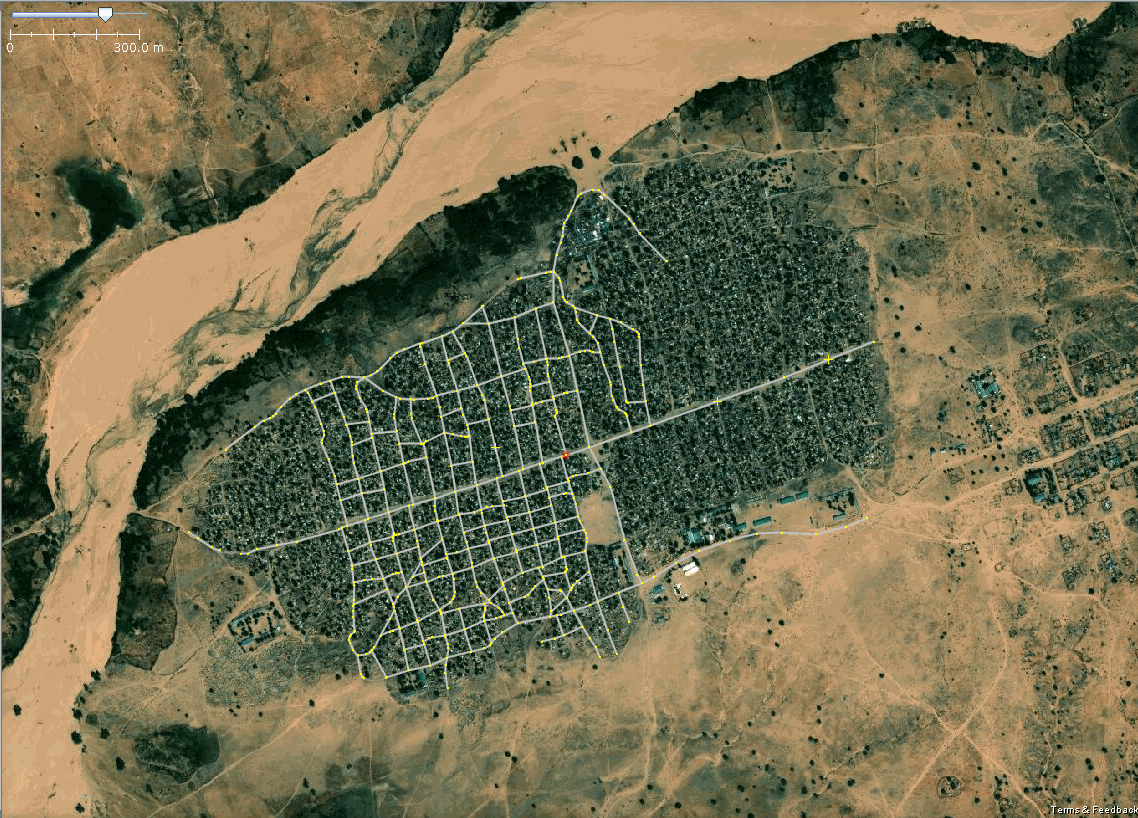
Fig. 46 Comparison of the Pre-update data VS Post-update data in Treguine Camp#
Challenges in the mapping#
The main difficulty during the mapping was the low quality of the baseline satellite imagery, which was more notable in some camps where the density of the buildings was high or in areas with a lot of trees.
Post-update stats#
At the end of the mapping, the data team completed the mapping of 21 of 22 camps. The table contains the final stats of buildings and roads added/improved per camp.
|
N° |
Camps |
Most current imagery |
Total buildings |
Total highway Length |
OSM link |
||
|---|---|---|---|---|---|---|---|
|
Baseline |
After mapping |
Baseline |
After mapping |
||||
01 |
Amboko Camp |
Maxar Premium |
1,813 |
3,368 |
8.051 km |
14.326 km |
|
02 |
Amnabak |
Maxar Premium |
398 |
6,896 |
1.472 km |
50.837 km |
|
03 |
Belom |
Maxar Premium |
4,450 |
9,598 |
27.338 km |
70.768 km |
|
04 |
Bredjing Camp |
Maxar Premium |
34 |
11,195 |
14.743 km |
34.452 km |
|
05 |
Daha 1 Village |
Bing Aerial |
222 |
1,821 |
6.035 km |
25.328 km |
https://www.openstreetmap.org/way/618226171 |
06 |
Dembo |
Maxar Premium |
2,324 |
3,701 |
41.02 km |
34.722 km |
|
07 |
Diba Village |
Maxar Premium |
0 |
468 |
0.455 km |
3.792 km |
|
08 |
Djabal Camp |
Maxar Premium |
4,884 |
9,259 |
49.163 km |
56.947 km |
|
09 |
Doholo Camp |
Maxar Premium |
2,037 |
2,218 |
3.314 km |
45.76 km |
|
10 |
Dosseye Camp |
Maxar Premium |
1,503 |
4,781 |
36.14 km |
81.961 km |
|
11 |
Farchana |
Maxar Premium |
7 |
7,524 |
37.94 km |
54.718 km |
|
12 |
Gaga Camp |
Maxar Premium |
18 |
11,647 |
13.735 km |
67.895 km |
|
13 |
Gondje Camp |
Maxar Premium |
1,168 |
2,273 |
38.339 km |
43.807 km |
|
14 |
Goz Amir Camp |
Maxar Premium |
133 |
22,318 |
25.83 km |
138.422 km |
|
15 |
Iridimi |
Maxar Premium |
8,213 |
12,486 |
20.555 km |
64.854 km |
https://www.openstreetmap.org/way/198678903 |
16 |
Kounoungou Camp |
Maxar Premium |
34 |
7,078 |
7.95 km |
40.216 km |
|
17 |
Mile Camp |
Maxar Premium |
5,343 |
6,910 |
21.314 km |
57.652 km |
|
18 |
Moyo |
Maxar Premium |
7 |
1,627 |
0.0 km |
33.172 km |
|
19 |
Oure Cassoni Camp |
Maxar Premium |
8,623 |
20,245 |
37.673 km |
80.44 km |
|
20 |
Touloum |
Maxar Premium |
7,832 |
9,672 |
53.97 km |
92.742 km |
|
21 |
Treguine Camp |
Maxar Premium |
0 |
11,962 |
19.522 km |
42.235 km |
|
22 |
Vom village |
Maxar Premium |
0 |
1,275 |
1.909 km |
9.251 km |
|
Since We completed the hours of the project, We were unable to map and validate the data of “Kounoungou Camp”, however, this was mapped by the community and now it presents more data compared to what was found in the pre-update report.