Data Assessment and Improvement#
The second phase of this project focused on improving geospatial data in a series of project locations. We experimented with two methods for improving public geospatial data, in all locations this focused on improving geospatial data in OpenStreetMap:
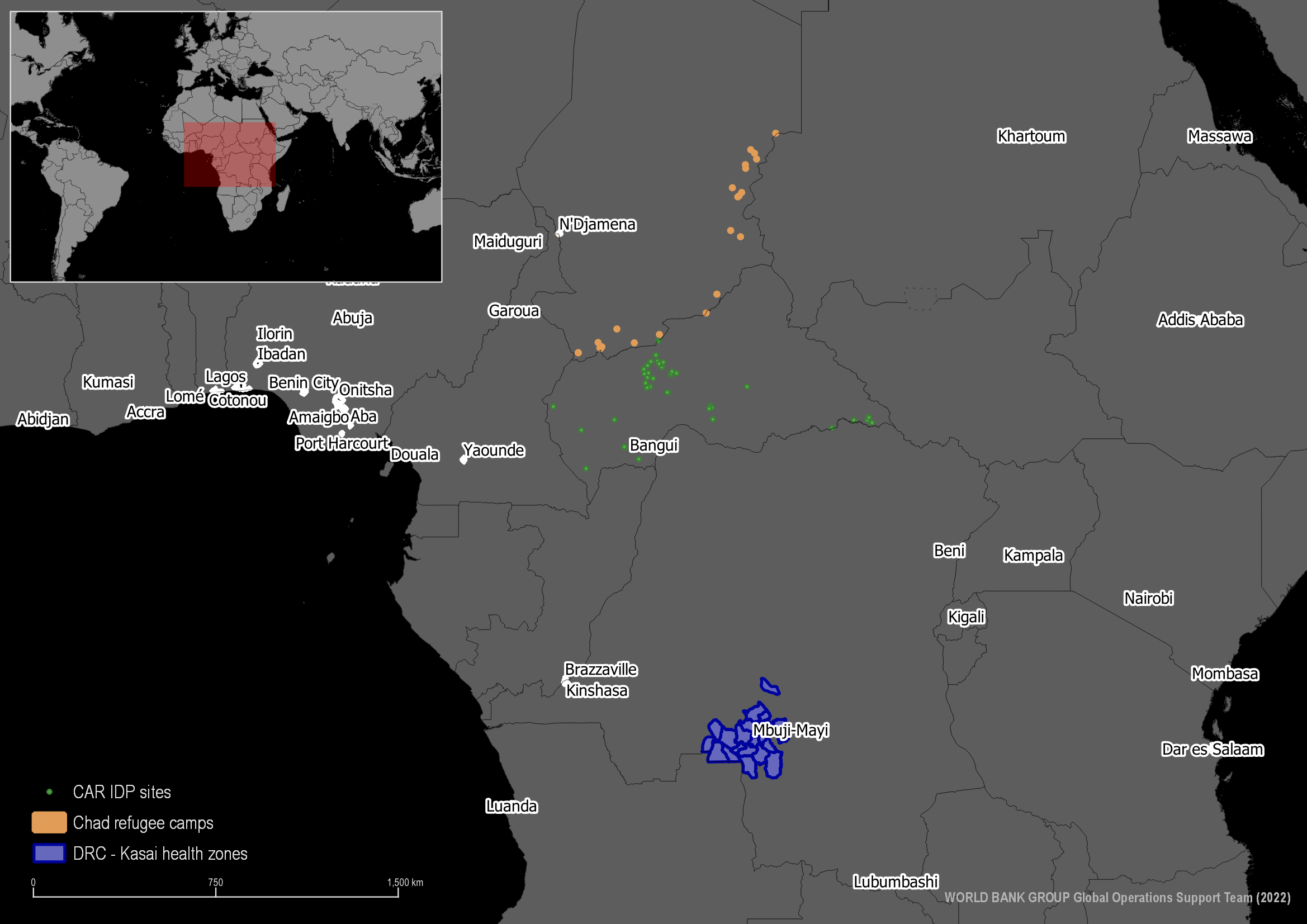
Fig. 10 Overview of 3 AOIs#
Project Locations#
Kasai, Democratic Republic of Congo#
Over the past five years, the DRC has consistently been in the top two countries with the highest number of new displacements associated with conflict (IDMC, 2021). In 2020 alone, the number of internally displaced people (IDPs) increased with an estimated 2.5 million individuals. Conflict accounted for nearly 90% of these displacements.
Given the huge data gap and indeed the challenge to collect data in this context, we explore the use of geospatial data to complement other more traditional data sources such as the Socio-economic survey in the Grand Kasai, DRC planned to take place in the coming months. It will focus on IDPs, returnees and host communities.
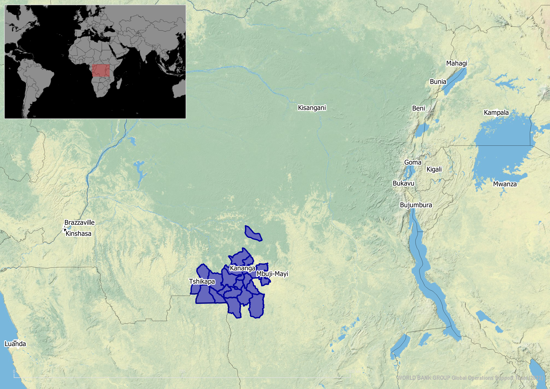
Fig. 11 Selected health zones#
Chad Refugee Camps#
Surrounded by pervasive conflicts in neighboring countries, Chad has received large numbers of refugees, asylum seekers, and returnees since the early 2000s, from Western Darfur, the Central African Republic, and most recently the Lake Chad Basin. As of January 2021, the country it self one of the poorest in the world was hosting nearly half a million refugees, more refugees per capita than any of the other African countries eligible for World Bank support for refugee-hosting countries
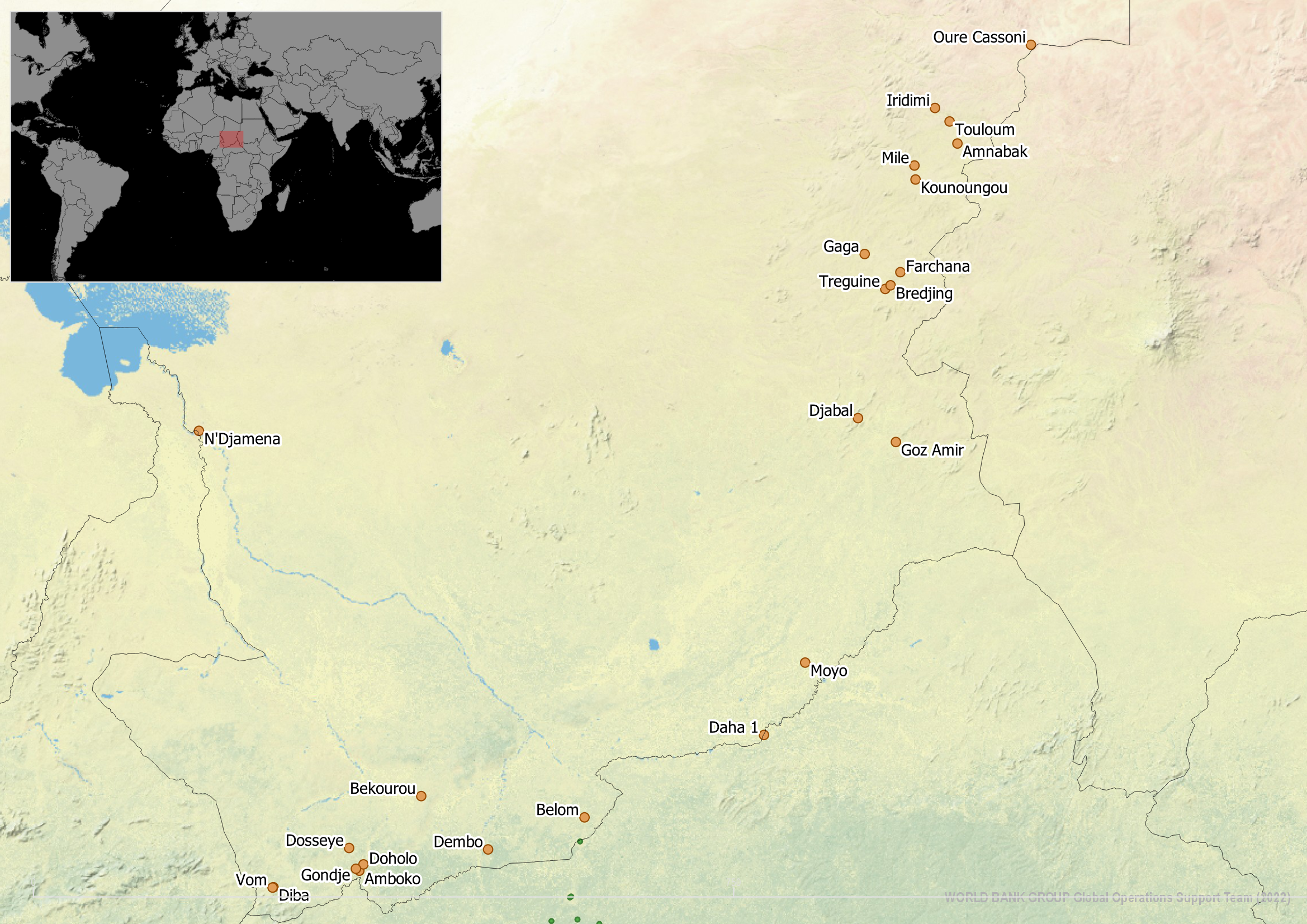
Fig. 12 Selected refugee camps#
IDPs in Central African Republic#
Central African Republic (CAR) … Lorem Ipsum
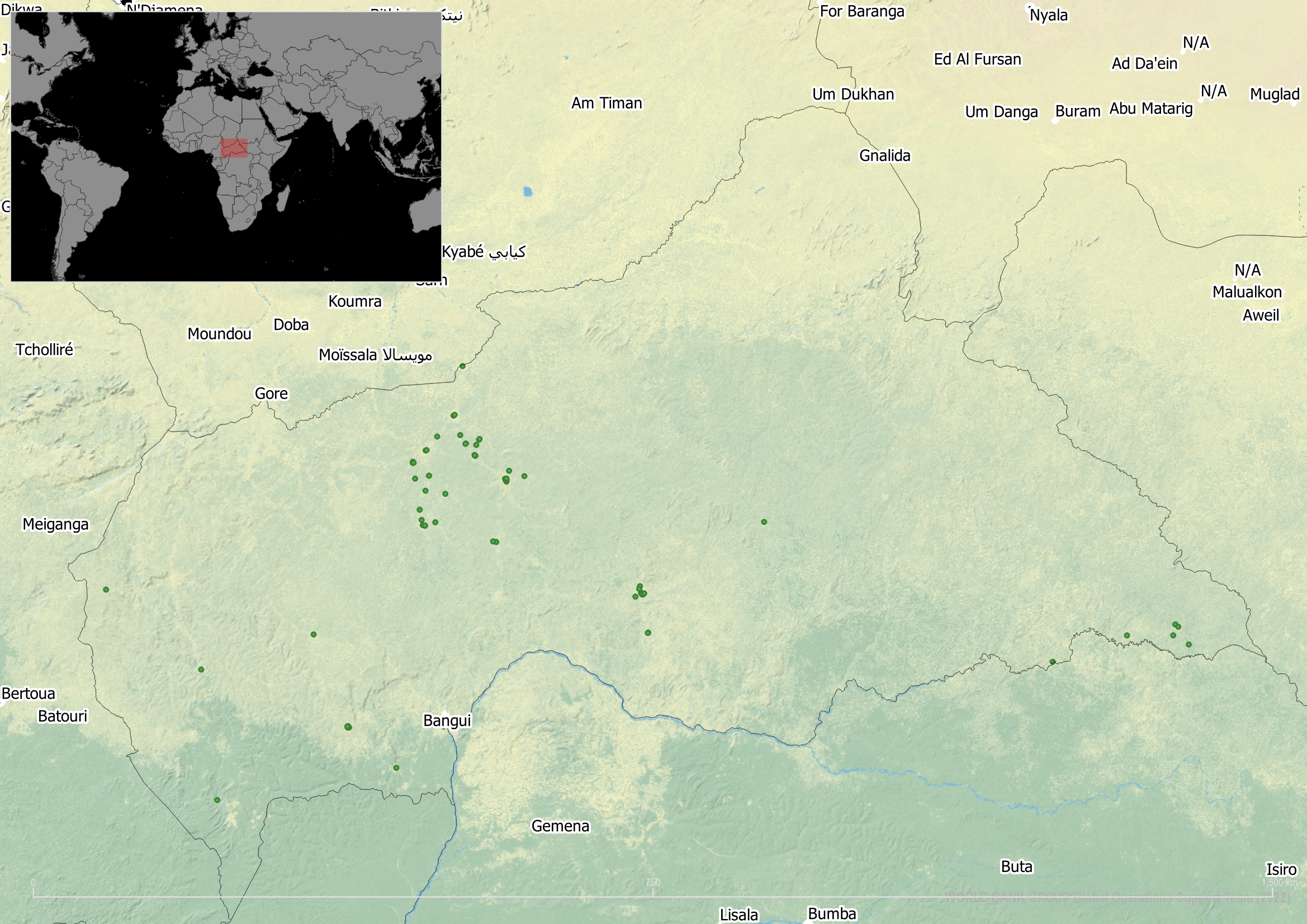
Fig. 13 IDP locations in CAR#
Method 1: consultancy#
We hired two companies to improve OSM data in two project locations: Kasai health zones and Chad refugee camps. In each of these locations we commisioned a set amount of time for each company to spend on improvements to OSM in their AOIs. Details on their approach and results can be found in later pages
Method 2: mapathon#
For one project location in the Central African Republic we had a mapathon