Abstract#
In this research for the World Bank and the Joint Data Center on Forced Displacement, we investigate how geospatial data are currently produced, handled, used, and shared by and among humanitarian and development actors, and the problems that arise. This document is the second phase of the report and presents a workflow for assessing data needs in humanitarian projects, focusing on understanding the process to move from information needs to data assessment to analysis. We build upon the conclusions from the first report where we draw upon a series of interviews and desk research to better understand how geospatial data are used by humanitarian actors and the problems they encounter.
Introduction#
We propose a standardized workflow for implementing geospatial analysis in situations of forced displacement; the five-step process is detailed below in figure 1.
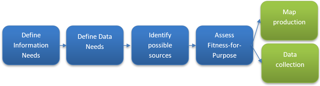
Fig. 6 Figure 1 - proposed data assessment workflow#