
Solar Panel Detection in Gaza#
This notebook demonstrates the process of detecting solar panels in satellite imagery using the Panel-Segmentation [2] tool developed by the National Renewable Energy Laboratory (NREL). The objective is to identify and locate solar panels in the Gaza region and estimate the extent of damange inflicted by the conflict.
Data#
In this section, we import from the data sources, available either publicly or through data licensing agreements. When using non-public data, please carefully abide by your organization’s data privacy policy, data classification and the terms and conditions. Please note that data is a placeholder relative directory where the data must be placed.
Area of Interest#
The area of interest for this project is the Gaza region. The satellite imagery used for solar panel detection covers specific locations within Gaza as shown below.

Fig. 22 Area of interest in Gaza. Above we represent a grid emcompassing the Gaza Strip in which each element has the dimensions of 215m and 215m with 15m overlay.#
Satellite Imagery#
The satellite imagery used in this project should be georeferenced and in a format supported by GDAL (e.g., GeoTIFF). The resolution and quality of the imagery can significantly impact the accuracy of solar panel detection. The satellite imagery should be clipped using the grid presented.
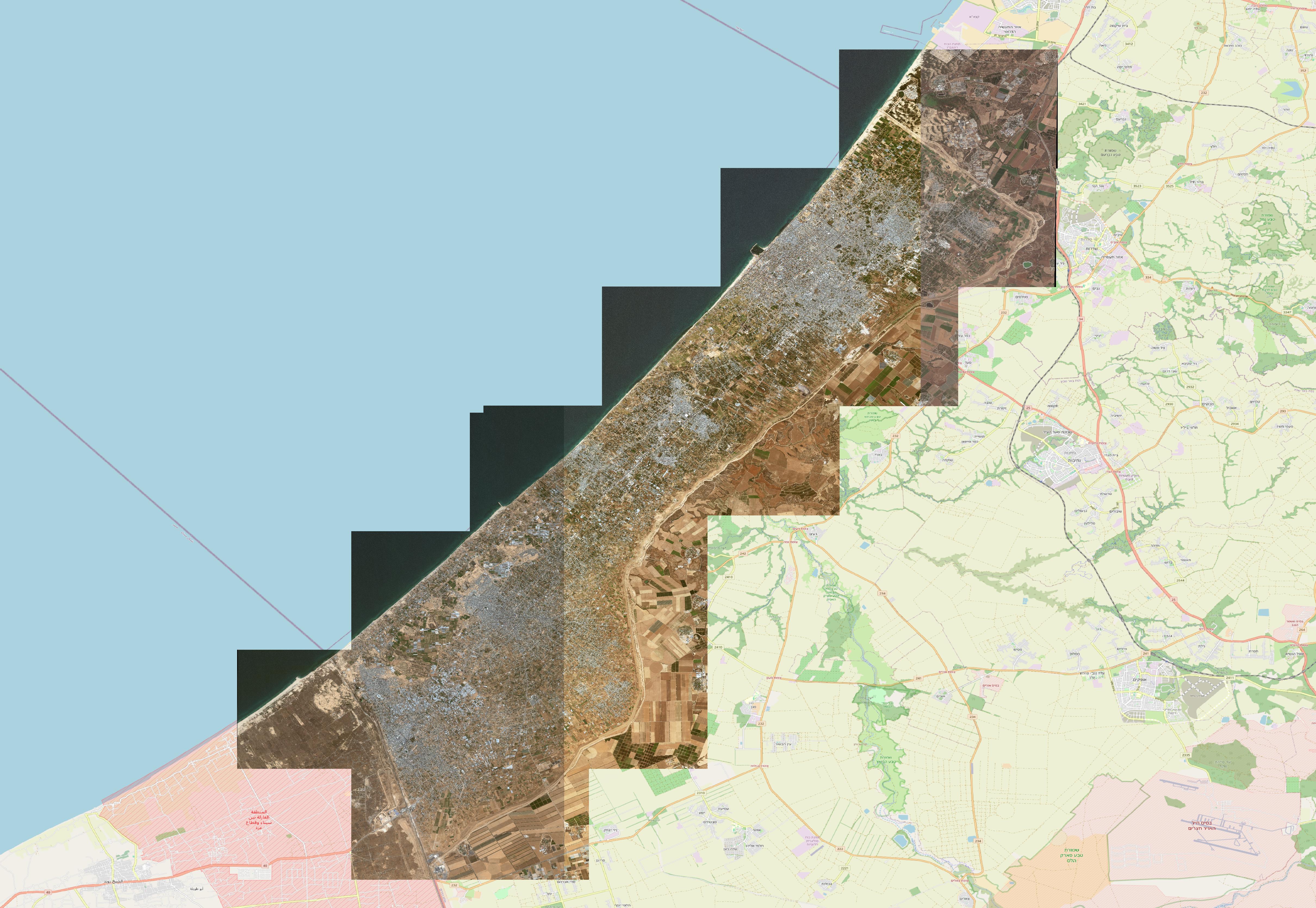
Fig. 23 Satellite imagery depicting the Gaza Strip as of May 2023.#
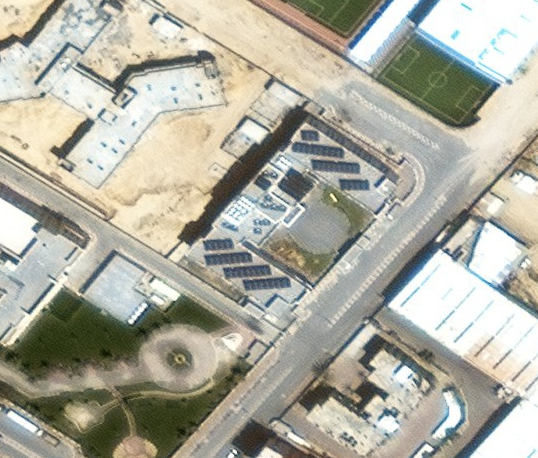
The solar panel detection will be carried out for each element in the area of interest. For example, we select the image as shown below to illustrate.
Methodology#
To identify solar panels within satellite imagery, we employthe Panel-Segmentation [2] tool developed by the National Renewable Energy Laboratory (NREL). Initially, we instantiate the PanelDetection class from the tool’s library and produce a satellite image corresponding to the specified latitude and longitude coordinates.
Solar Panel Detection#
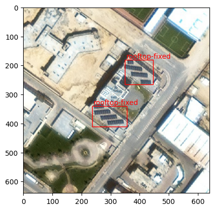
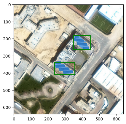
Utilize the classifier model to verify the presence of solar arrays in the satellite image. Subsequently, classify the image based on its mounting configuration using the object detection algorithm for mounting configurations.
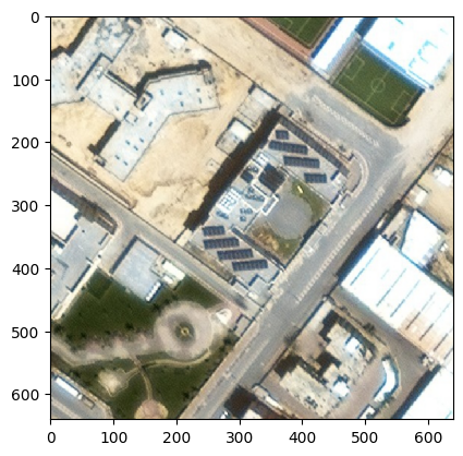
Load the image, resizing to (640, 640), and initialize it as a NumPy array.
Solar Panel Segmentation#
After detecting solar panels in the satellite image, the next step involves segmenting the iamge for further analysis and identification. For this purpose, we employ the Segment Anything [1] framework, a versatile and powerful tool designed for precise image segmentation tasks. This framework utilizes advanced segmentation algorithms to accurately delineate the boundaries of objects within an image, in this case, the solar panels.
Results#
In this section, we present the compiled results. In practice, we repeat the process described above for each element in the area of interest.
Fig. 24 Map illustrating the estimated distribution of solar panels across the Gaza Strip as of May 2023.#
Ultimately, we determine the estimated capacity in area (\(m^2\)).
553338.15 square meters of estimated capacity in area.
Damage Estimation#
Mapping damage in Gaza due to conflict using Synthetic Aperture Radar (SAR) provides an approach for assessing and quantifying the extent of destruction. By comparing pre- and post-conflict SAR images, we can identify changes in infrastructure and buildings, such as solar panels.
Fig. 25 Map illustrating the estimated distribution of solar panels across the Gaza Strip as of May 2023, overlaying estimated damage from SAR (Synthetic Aperture Radar) images.#
Ultimately, we determine the estimated capacity in area (\(m^2\)) that is damaged.
138426.66 square meters of estimated capacity in area that has been assessed as damaged.
In conclusion, we ascertain the percentage of damaged solar panels within each governorate.
Fig. 26 Map illustrating the percentage of estimated solar panels across the Gaza Strip as of May 2023, overlaying estimated damage from SAR (Synthetic Aperture Radar) images.#
Limitations#
Using computer vision and machine learning to detect solar panels from satellite imagery can be a powerful approach, but it comes with several limitations:
Caution
Resolution Limitations: Satellite imagery may not always have high enough resolution to accurately detect small or densely packed solar panels. This can result in missed detections or incorrect identification.
False Positives/Negatives: Machine learning algorithms may produce false positives (incorrectly identifying objects as solar panels) or false negatives (failing to detect actual solar panels), leading to inaccuracies in the detection results.
Complex Backgrounds: Satellite imagery often contains complex backgrounds such as buildings, vegetation, and other structures. This complexity can confuse algorithms and lead to false positives or missed detections.
Data Availability and Quality: Availability and quality of satellite imagery can vary depending on factors such as sensor capabilities, acquisition frequency, and access restrictions. Limited or poor-quality data can hinder the effectiveness of machine learning detection algorithms.
Training Data Availability: Training a machine learning model to accurately detect solar panels requires a large amount of labeled data, which may be costly and time-consuming to acquire. Furthermore, obtaining diverse training data that captures the variability of real-world conditions can be challenging.
References#
- 1
Alexander Kirillov, Eric Mintun, Nikhila Ravi, Hanzi Mao, Chloe Rolland, Laura Gustafson, Tete Xiao, Spencer Whitehead, Alexander C. Berg, Wan-Yen Lo, Piotr Dollár, and Ross Girshick. Segment Anything. arXiv:2304.02643, 2023. doi:10.48550/arXiv.2304.02643.
- 2(1,2)
National Renewable Energy Laboratory. NREL/Panel-Segmentation. NREL/Panel-Segmentation, 2022.