Activity Trends in Gaza#
This notebook explores the actvity index calculted by Mapbox Movement Data. This analysis is still exploratory and has not been validated yet.
Insights#
Make this Notebook Trusted to load map: File -> Trust Notebook
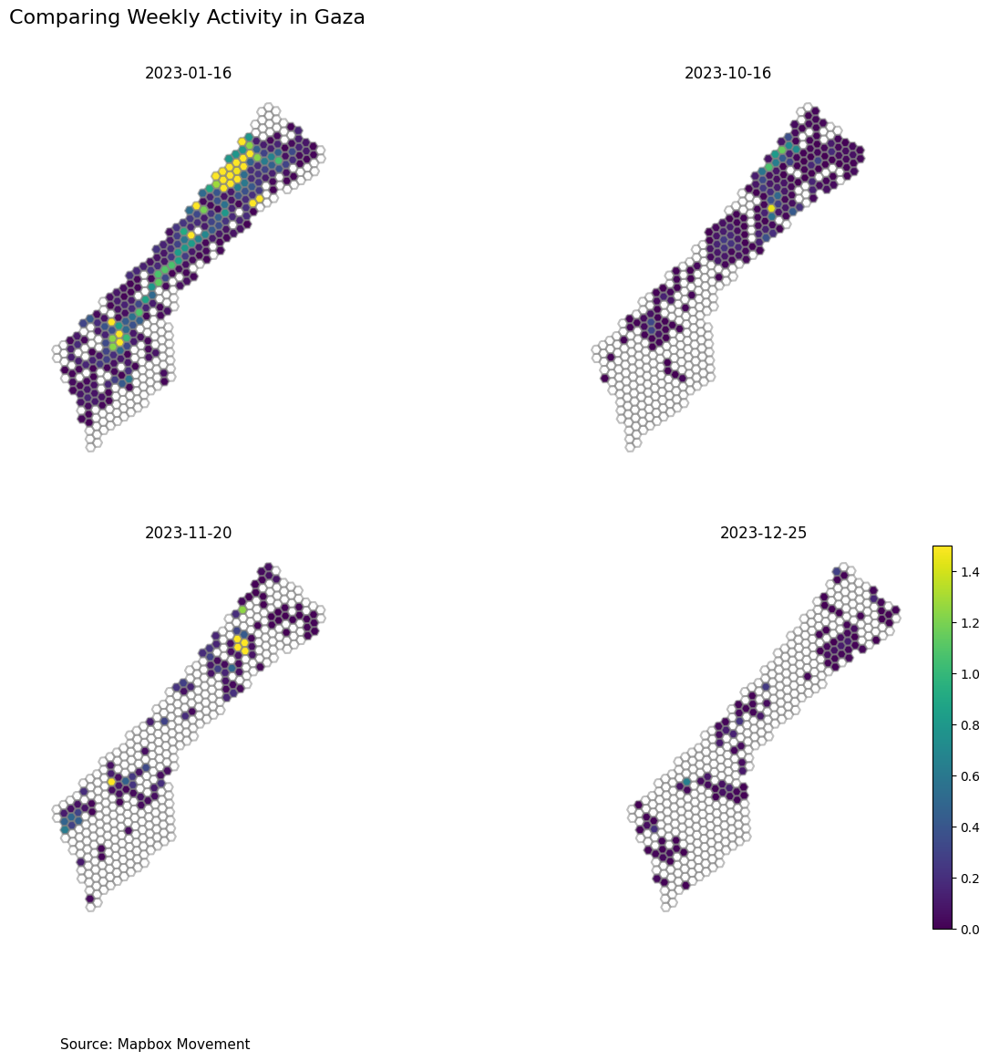
Weekly Activity Trends Before and After the Conflict#
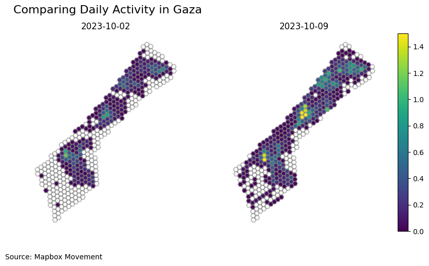
Mapping the activity before and after the conflict#