GeoE3 - Geospatial mapping of Enabling Environments for Employment#
For complete project information, please click here
With support from the Canada Clean Energy and Forest Climate Facility (CCEFCF) and the Global Data Facility (GDF), the Geospatial Operational Support Team (GOST, DECSC) launched the project “Geospatial Assessment of Women Employment and Business Opportunities in the Renewable Energy Sector.” The project proposed a novel methodology for mapping the enabling environments for women’s employment that evolved into the current GeoE3 initiative.
In addition to the methodology, the project has generated a geospatial open-source, QGIS tool for implementing the methodology. For more details, visit the GeoE3 project directly.
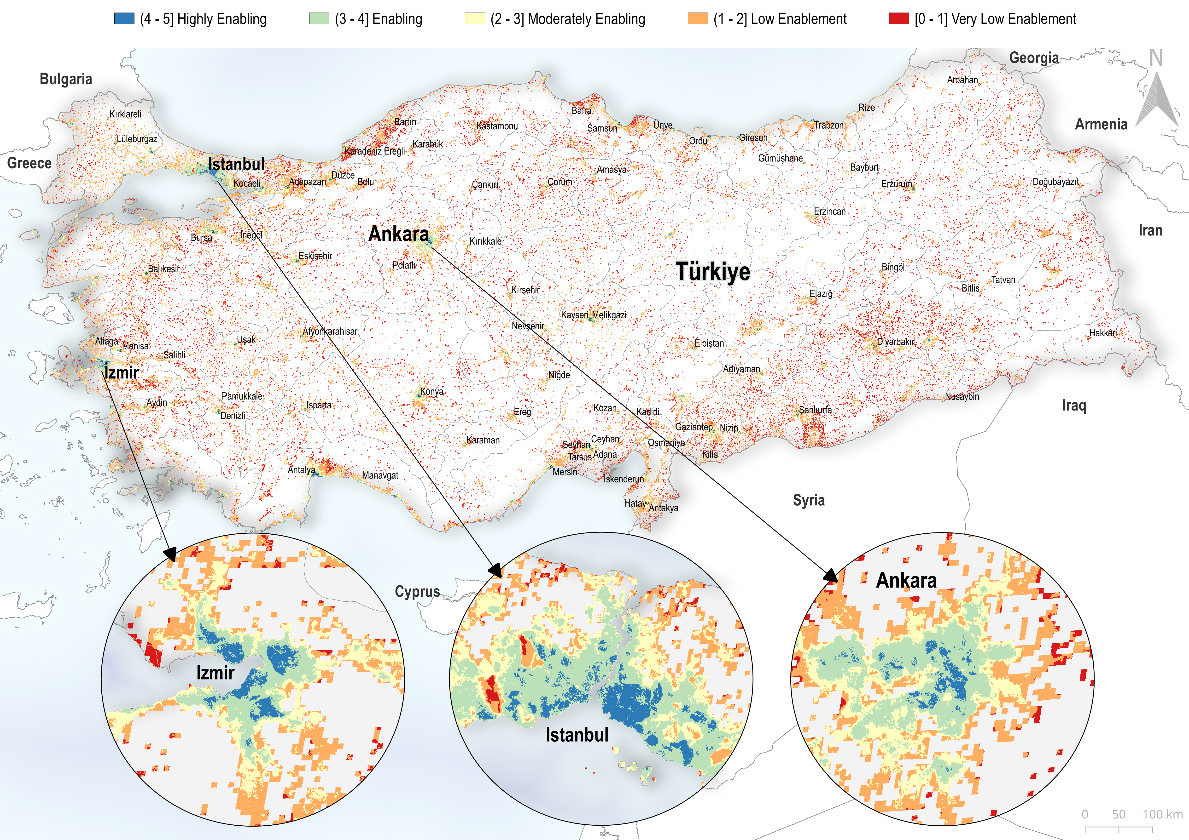
Fig. 3 Most recently, GeoE3 was used to calculate the enabling scores for employment in Albania, Bulgaria and Turkey#
Countries included in the first phase of the project:
AFRICA |
LATIN AMERICA AND CARIBBEAN |
EAST ASIA AND PACIFIC |
SOUTH ASIA |
|---|---|---|---|
Cabo Verde |
Antigua and Barbuda |
Federated States of Micronesia |
Maldives |
Comoros |
Belize |
Fiji |
|
Guinea-Bissau |
Dominica |
Kiribati |
|
Mauritius |
Dominican Republic |
Marshall Islands |
|
São Tomé and Príncipe |
Grenada |
Nauru |
|
Guyana |
Niue |
||
Haiti |
Palau |
||
Jamaica |
Papua New Guinea |
||
St. Lucia |
Samoa |
||
St. Vincent and Grenadines |
Solomon Islands |
||
Suriname |
Timor-Leste |
||
Tonga |
|||
Tuvalu |
|||
Vanuatu |